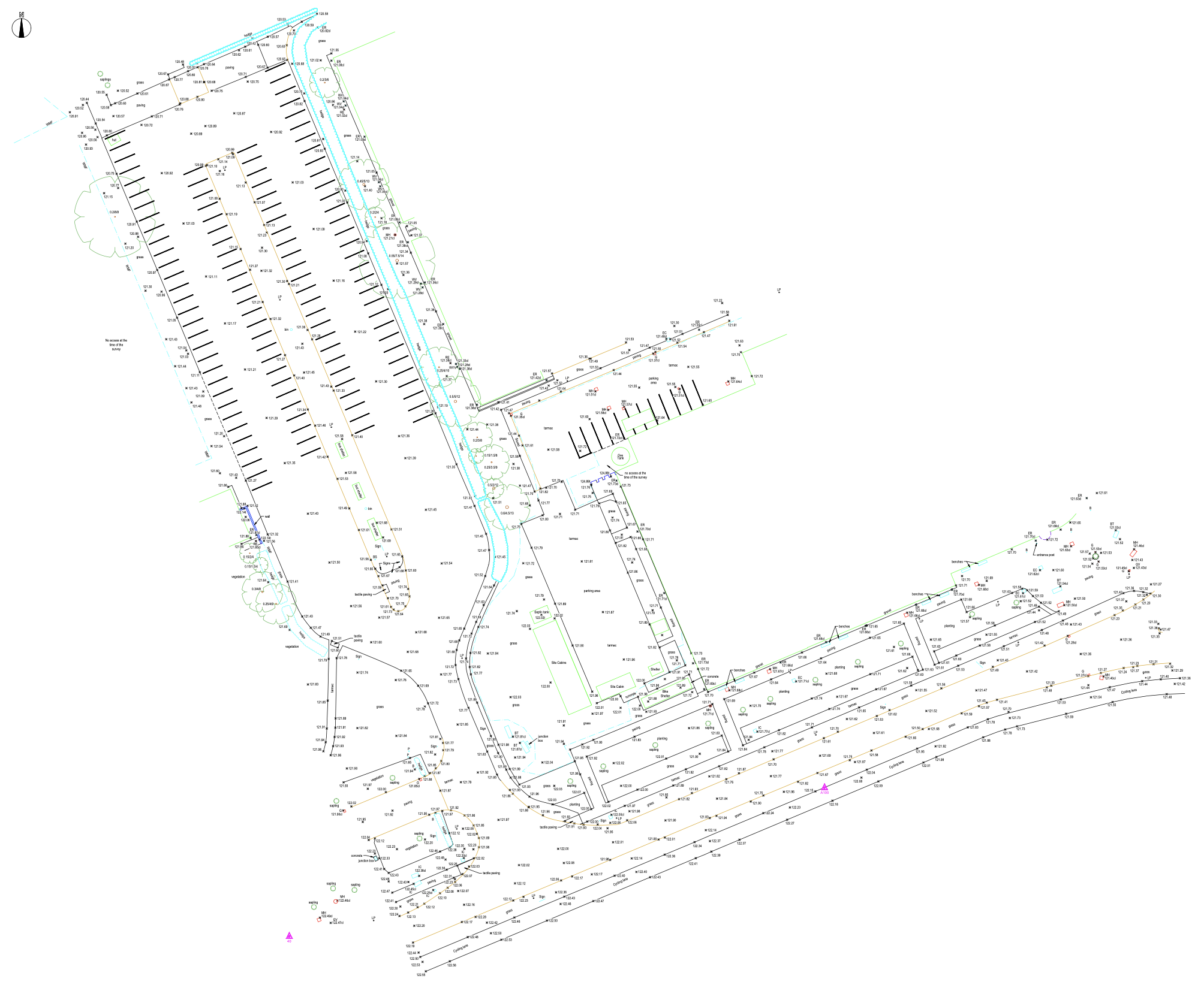
As Built Surveys
We produce high quality CAD drawings from your surveyed data.
Using industry-standard software like LSS, we conduct comprehensive quality checks to ensure that every aspect of the survey meets stringent industry standards.
Our expertise extends to processing field data in various formats including GSI, ASCI, and DBX, seamlessly integrating any accompanying sketches for comprehensive documentation.
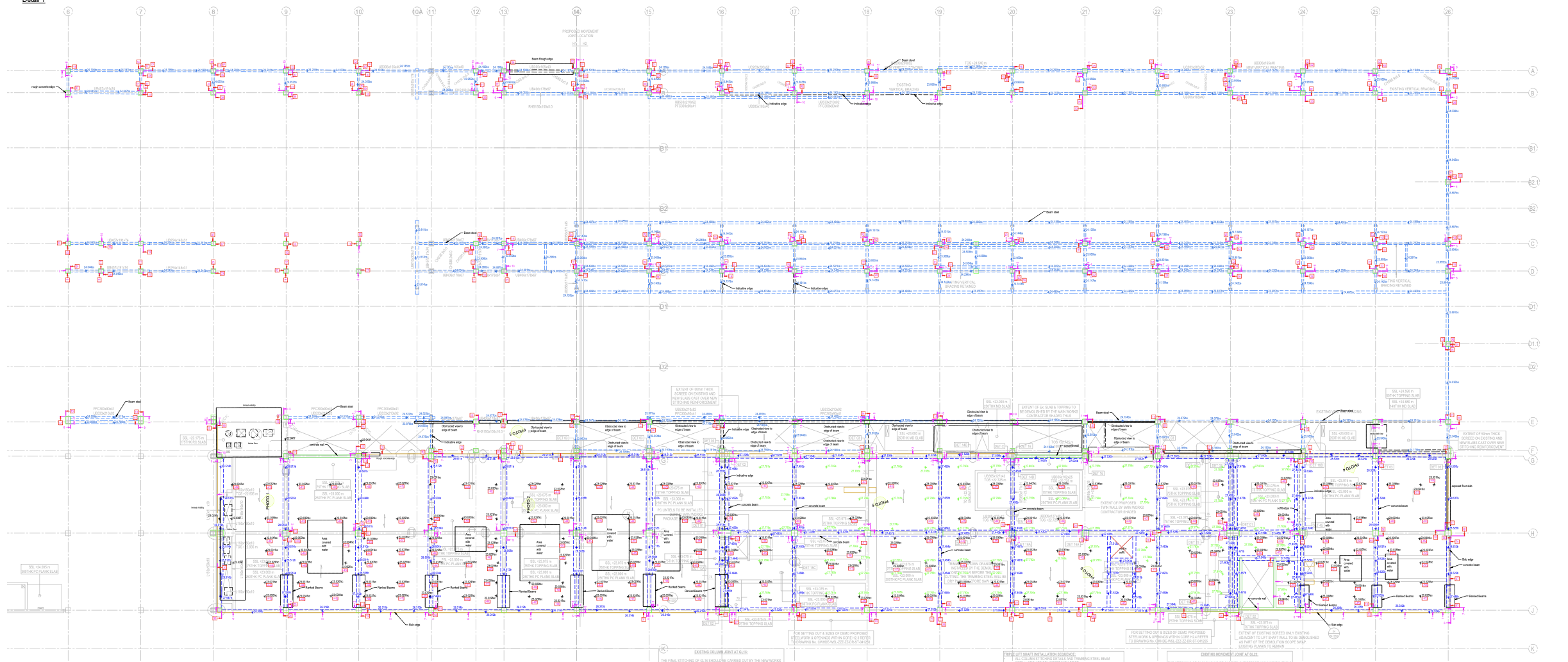
Verification Surveys
We produced high quality CAD drawings from your survey data.
We meticulously compare surveyed data with design information and identify any discrepancies, ensuring that our deliverables accurately reflect the as-built reality.
Using industry-standard software like LSS,
we conduct comprehensive quality checks
to ensure that every aspect of the survey meets stringent industry standards;
Our expertise extends to
processing field data in various formats including GSI, ASCI, and DBX, seamlessly integrating any accompanying sketches for comprehensive documentation.
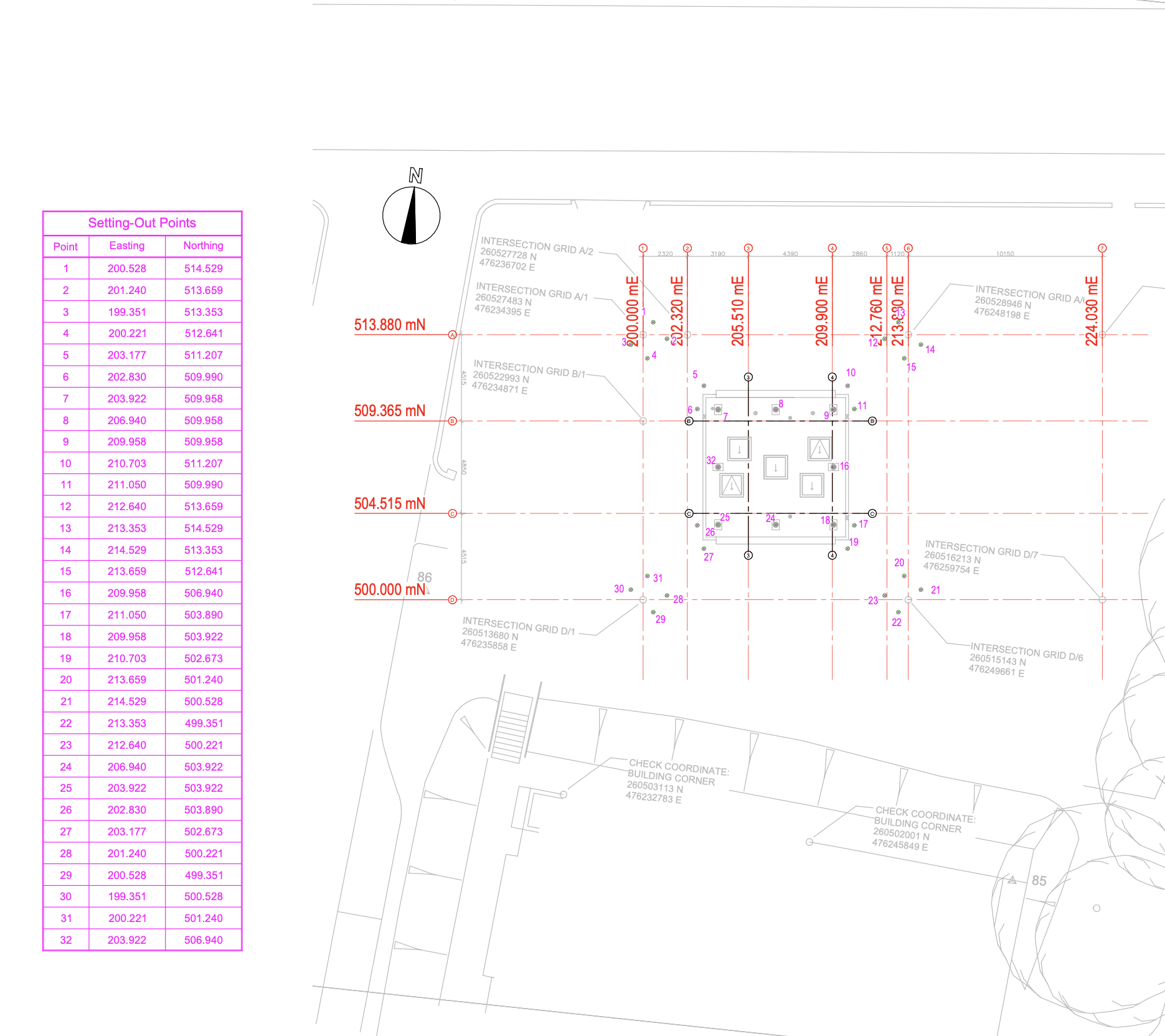
Setting Out Drawings
We prepare CAD drawing showcasing setting out points to be marked on-site.
List of coordinates accompanying the CAD drawing.
Deliver also Text/GSI/CSV file containing the list of coordinates to optimise time spend on site.
Quality Checks Included:
- Basic checks conducted to ensure design information coherence;
- Verification that design elements such as grid lines adhere to required standards;
- Guarantee of accuracy and alignment between design specifications and setting out requirements.
Our Services
We specialize in delivering precise AutoCAD drawings, tailored to your needs and backed by cutting-edge technology and expert guidance for seamless project execution.